

 Schwarzer Schöps
 Petite Glane
 Cechticky
 Cherio
 Dotnuvele
 Dviete
 Hobol
Hobol La Wimbe
 Pesnica
 Upper Zglowiaczka
 Sävjaan
Meet Felső-Válicka – Hungarian Case Study
The Felső-Válicka case study is located in Western Hungary, within the watershed area of Lake Balaton, which is the largest freshwater lake in Central Europe. The Felső-Válicka stream is 27 km long, and the total area of its catchment is 124 km². It flows directly into the Zala River, the main inflow of water to the lake.
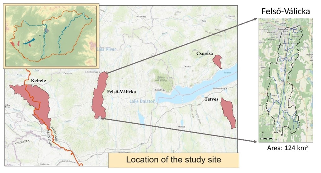
Figure 1: Location of Felső-Válicka case study
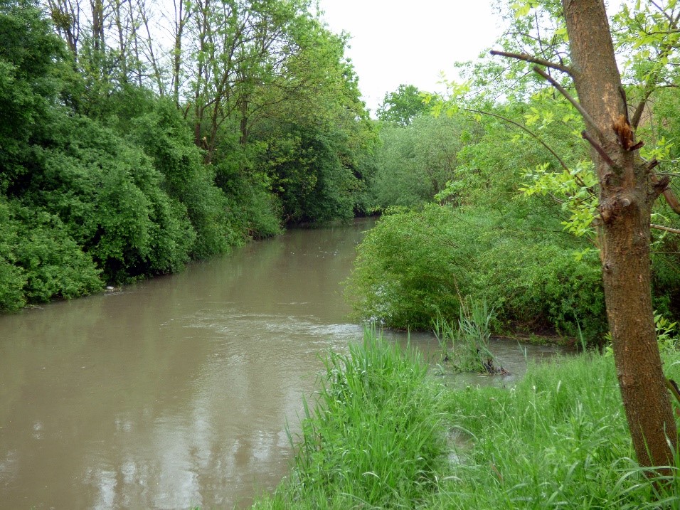
Figure 2: Felső-Válicka stream flowing into the Zala River
The water quality of the Felső-Válicka stream and the Zala River greatly affects the environmental condition of Lake Balaton, making it crucial to prevent any pollution from human activities. But the aim is not only to protect the watercourses and the lake but also to achieve sustainable land use in the catchment area. A significant part of the study area is used for agricultural production: about 35 % of the total area is cropland. Presumably due to climate change farmers are facing increasingly severe challenges, from drought to floods and soil erosion, which lead to reduced crop yields and increased costs. To preserve water quality and ensure sustainable agriculture, improved water management of the area is essential.
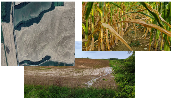
Figure 3. Environmental problems on the agricultural fields of Felső-Válicka case study
In the OPTAIN project, we selected measures in consultation with farmers that are realistically achievable and can improve the area's water and soil conditions. During consultations and workshops, it became clear that farmers are already implementing water retention measures (e.g., reduced tillage and cover crops), but these are only partially effective. Therefore, for the SWAT+ modelling, we selected measures that are likely to be more effective than the solutions currently in use.
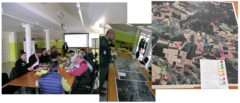
Figure 4. Meeting with local farmers and stakeholders to find optimal solutions for improving water management in the Felső-Válicka case study
Based on the information collected from local farmers and the recommendations of farm advisors the following NSWRMs were included in the scenario analysis:
(1) implementation of riparian buffer,
(2) forested buffer strips between halved parcels,
(3) no-till management with cover crops.
Riparian forest buffers were applied along the stream 20 m wide on those fields which had land cover type other than forest. Field diving and implementing buffer strips was applied on those agricultural fields which are currently larger than 50 ha. No-till management with cover crops was applied on all croplands.
Based on the initial results, it appears that no-till with cover crops is the most effective measure for preserving soil moisture and reducing erosion. However, riparian forests and buffer strips can also help reduce sediment loss from agricultural fields. At the upcoming meeting with the farmers in the fall of 2024, we plan to discuss their opinions on our results and how feasible they consider the proposed measures, taking into account the associated work and costs.
Authors: Piroska Kassai, Brigitta Szabó, Péter Braun